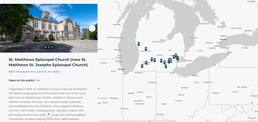
The state has launched a new interactive map to help show Michigan’s involvement in the underground railroad.
The map allows users to click on a point in Michigan where there was railroad activity. Each point has a picture and comments about the event.
The map is meant to be an accessible tool for teachers to use and be a launchpad for further research, said Amanda Campbell Crawford, commissioner for the Michigan Freedom Trail.
"As technology progresses with geographic information systems and interactive abilities, this seemed like a natural step to start to collate all this information and be able to talk about all these different stories," she said.
The points on the map are meant to entice users to research more about what happened on their own.
“We have seen just folks that are excited for the snow to melt hopefully throughout this storm that’s coming (so they can) get out to these sites that they see and click on in this interactive map, and then they can travel and learn more about it," she said.
The map is maintained by the Michigan History Center using a grant from the US National Park service, Campbell Crawford said.
The interactive map can be found here.

